NAGARJUNASAGAR DAM
Preamble
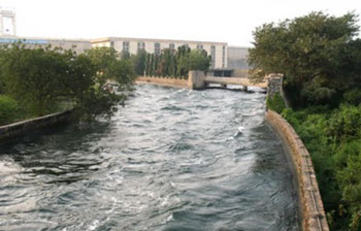
The construction of the Nagarjunasagar Dam was commenced in the year 1956 and completed by the year 1967. It is one of the Modern Temples of Free India and the pride of Andhra Pradesh. This is the largest and highest masonry dam in the world. The total length of Dam is 15956 Ft (4863 mts), with a Full Storage Capacity of 408.24 TMC & Live Storage of 202.47 TMC. The F.R.L. of the Dam is 590.00 Ft., and the water spread area of the Dam is 285 Sq. Km. There are 26 Nos. of Radial Crest Gates with a Spillway capacity of 42,476 cumecs. Water was let into the Right Canal by Smt. Indira Gandhi on 4.8.1967
Canal Network
| Nagarjunasagar Right Canals | Nagarjunasagar Left Canals | ||||
|---|---|---|---|---|---|
| 1. | Length of Main Canal | 203 KM | 126 Miles | 179 KM | 111 Miles |
| 2. | Maximum bed width | 73.5 Mt. | 241 feet | 29 Mt. | 95 feet |
| 3. | Depth of flow (head reach) | 3.78 Mt. | 12.4 Ft. | 6.71 Mt. | 22 feet |
| 4. | Maximum discharge | 311.5 Cum/Sec | 11000 C/S | 311.5 Cum/Sec | 11000 C/S |
| 5. | Head regulator:a)Sill level | +149.05 Mt. | 489.00 ft. | +149.05 Mt. | 489.00 ft. |
| b) Vent way | 9 vents of 10' x 15'(3.05 m x 4.575 m) | 3 vents of 10' x 25'(3.05 m x 7.62 m) | |||
| 6. | Length of branches and distributories | 5342 KM | 3320 Miles | 7722 KM | 4.800 Miles |
| 7. | Length of field channels | 14400 KM | 9000 miles | 9654 KM | 6000 Miles |
| 8. | Localized ayacut | 4.52 Lakh Ha. 11.17 Lakh acres | 4.08 Lakh Ha. 10.08 Lakh acres. | ||
Jurisdiction:
There are three Circles in the jurisdiction of Chief Engineer as follows.
I. NSJC, O & M Circle, Lingamguntla
This Circle is in charge of Operation & Maintenance of Nagarjunasagar Jawahar Canal (N.S. Right Canal) from Mile 0/0 to M 85/3+150 (Km 0.000 to Km 137.28) with a designed discharge of 11,000 cusecs covering block Nos. 1 to 10, Part of 11, 11A to 14, Part of 17 to 19 of N.S.J.C., Command Area. The localized ayacut under the control of this Circle is 6,74,263 Acres (2,49,434 Wet + 4,24,829 ID) covering both the districts i.e., Guntur and Prakasham.
II. Irrigation Circle, Ongole
This Circle is in charge of Operation & Maintenance of Nagarjunasagar Jawahar Canal from M 85/3+150 to M 126/0+000 (Km 137.28 to Km 202.79) covering block Nos. 15 to 22 of NSJC Command Area. The localized ayacut under the control of this Circle is 4,42,374 Acres (1,85,516 Wet + 2,56,858 ID) covering Prakasam district.
III. Pulichintala Project Circle, Jaggaiahpet
Consequent on re-organisation of State of Andhra Pradesh, Government have issued orders vide Memo No. 9424/Ser.II-1 dated 10.6.14 that O&M Division, Jaggaiahpet (previously under O&M Circle, Miryalaguda) and O & M Division, Nuzividu (previously under O&M Circle, Tekulapalli) are attached to Pulichintala Project Circle, Jaggaiahpet with effect from 10.6.14. This Circle is in charge of Operation & Maintenance of 21st Main Branch Canal from Km 102.00 to 117.007 (tail end) covering block Nos. 15 to 22 of N.S.J.C., Command Area. The localized ayacut under the control of this Circle is 3,61,160 Acres (48,170 Wet + 3,12,990 ID) in Krishna district; and 1804 acres of ID in West Godavari district.
IV. Water Allocation:
The allocated quantum of water by KWDT for the entire Right Canal (22 Blocks) is 132 TMC, out of which 79.67 TMC is allocated to O&M Circle, Lingamguntla and 52.33 TMC to Irrigation Circle, Ongole proportionately on the basis of localized ayacut. The entire right command is divided in to 2 zones for the purpose of water regulation. Zone I broadly covers Guntur district and it is up to M 55/3 of Jawahar Canal and 33/2+258 of ABC. Zone II covers Prakasam district and from 55/3 to 85/3+150 of Jawahar Canal and beyond 33/2+258 of ABC. Water is normally released to Zone I on the first week of August depending on the availability of water in the reservoir. Depending on the subsequent receipt of water in the reservoir water is released to Zone II with a gap of 2 to 4 weeks. The allocated quantum of water by KWDT for the entire Left Canal is 132 TMC, out of which 32.25 TMC is allocated to Andhra Region i.e., to Krishna district now under Pulichintala Project Circle. The entire left command is divided in to 3 zones for the purpose of water regulation. Broadly Zone I covers Nalgonda district (upto Km 136.79 of NSLBC, Palair) and Zone II covers Khammam district (Km 136.79 to 178.27 of Main canal and Km 0.000 to 102.000 of 21st Main Branch Canal) and Zone III covers Krishna district (Km 102.000 to km 117.007 of 21st Main Branch Canal). Water is normally released to wet crops from August to December continuously and for ID crops from November to February.
V. Drinking water needs
There are 506 Drinking Water Tanks (8 PH Tanks & 195 RWS Tanks, 99 Cattle Ponds, 204 Village kuntas) for which water is being supplied from the canal network system under the control of O&M Circle, Lingamguntla.
There are 122 Notified and 108 Non-notified drinking water tanks and two S.S. tanks for which water is being supplied from the canal network system under the control of Irrigation Circle, Ongole.
VI. Power Plants
Besides supplying water to Irrigation needs and drinking water needs there exists a Power House on N.S.J.C., with an installed capacity of 90 MW.
Further, there are 25 Mini Hydel Schemes installed on the Distributory Network (GBC, ABC, ZBC, BBC & PBC) under the control of O&M Circle, Lingamguntla with an installed capacity of 40 MW all together.
Also, there are 2 Mini Hydel Schemes installed on the Distributory Network (OBC & ABC) under the control of Irrigation Circle, Ongole with an installed capacity of 4 MW all together.
Salient Features
| Latitude | : | 16°34'23"N. |
| Longitude | : | 79°18'47"E. |
| HYDROLOGY | ||
| Catchment area at Dam site | : | 83,083 Sq.miles (2,15,185 Sq.KMs) |
| Maximum annual rain fall in the Catchment | : | 35" (889 MM) |
| Maximum observed flood | : | 30,050 cumecs (10.61 Lakh C/s) |
| Minimum dry weather flow | : | 2.80 cumecs (100 C/S) |
| 1000 years design flood | : | 58,340 cumecs (20.60 Lakh C/S) |
| Routed flood | : | 45310 Cumecs (16.00 Lakh C/S) |
| RESERVOIR: | ||
| F.R.L. | : | +590.00 Ft. (+179.832 Mt.) |
| Maximum water level | : | +594.00 Ft. (+181.051 Mt.) |
| Dead storage level | : | +400.00 Ft. (+121.920 Mt.) |
| M.D.D.Ls: | ||
| As per Nandikonda Project report | : | +510.00 Ft. (+155.450 Mt.) |
| Water spread area | : | 110 Sq.Miles (285 Sq.KMs) |
| MASONRY DAM: | ||
| Length of spill way Dam | : | 1545 Ft. (470.916 Mts.) |
| Length of Non-over flow Dam | : | 3211 Ft. (978.612 Mts.) |
| Total length of Masonry Dam | : | 4756 Ft. (1449.628 Mts) |
| Maximum height of Dam above deepest Foundation | : | 409 Ft. (124.663 Mts.) |
| Top width of Dam | : | 28 Ft. ( 8.534 Mts.) |
| Maximum base width of Dam | : | 320 Ft. ( 97.536 Mts.) |
| Over-all width of road way at top | : | 30 Ft. 9 inch. (9.373 Mts) |
| Deepest foundation level | : | +196.00 Ft. (+59.741 Mts) |
| Average river bed level | : | +245.00 Ft.(+74.676 Mts.) |
| Spillway crest level | : | +546.00 Ft. (+166.421 Mts.) |
| Top of crest gates | : | +590.00 Ft.(+179.832 Mts.) |
| Top of Dam | : | +605.00 Ft. (184.404 Mts.) |
| Invert level of flip bucket | : | +240.00 Ft. (73.15 Mts.) |
| Crest gates | : | 26 Nos. of size 45' x 44' (13.716 x 13.410) Mts. |
| Chute sluices | : | 2 vents of size 10' x 25'with sill at +450' (137.16 Mts) |
| (Operable up to +549.00 Ft) | : | Discharging 17,000 C/S at full gate opening. |
| Diversion Tunnel(Operable up to +560.00 Ft.) | : | 2 Vents of size 10' x 25' Discharging 20,000 C/S at full gate Opening. |
| Right Canal Head sluice | : | 9 vents of size 10' x 15' with sill At +489' (149.047 Mt.) |
| Left Canal Head sluice | : | 3 vents of size 10' x 25' with sill At +489' (149.047 Mt.) |
| EARTH DAM: | ||
| Length of Left Earth Dam | : | 8400 Ft. (2560.32 Mts.) |
| Length of Right Earth Dam | : | 2800 Ft. (853.44 Mts.) |
| Total Length | : | 11,200 Ft. (3413.76 Mts.) |
| Maximum height | : | 85 Ft. (25.908 Mts.) |
| Top width | : | 30 Ft. 6" (9.296 Mts.) |
| Top level | : | +610 Ft. (+185.928 Mts.) |
| POWER GENERATION: | ||
| Penstocks ( 8 numbers) | : | 16.00 Ft. dia (4.88 Mts) |
| Centre line elevation | : | +405.00 ft. (+123.40 Mts.) |
| Power Units | : | 1 number conventional.(with 110 MW capacity)7 Nos. reversible (with 100MW capacity) |
| MDDL | : | +506.00 Ft. (_154.23 Mts.)(for conventional) +495.00 Ft. (+150.88 Mts.) |
| Discharging capacity | : | 4,700 C/s (133.09 Cumecs)(for conventional)4,300 C/S (121.76 cumecs)(for reversible) |
| Right Canal Power House: | ||
| Sluices | : | 3 Numbers 15' x 38' (4.57 M x 38 M) |
| Sill level | : | +479.00 Ft (146.00 Mts) |
| Units | : | 3 Numbers conventional |
| Capacity | : | 30 MW |
| Discharging capacity | : | 5,000 Cusecs each |
| Left Canal Power House | : | Two Units |
| Stages of Dam operation for Irrigation & Power Generation: | ||
| Full Reservoir Level (FRL) | : | +590.00 feet |
| Capacity @ FRL | : | 312.045 TMC |
| Spillway Crest level (crest) | : | +546.00 feet |
| Capacity @ crest | : | 201.053 TMC |
| Minimum Draw Down Level (MDDL) | : | +510.00 feet |
| Capacity @ MDDL | : | 131.669 TMC |
| Minimum level for pumping drinking water to twin cities | : | +508.00 feet |
| Capacity @ +508 | : | 128.299 TMC |
| Sill Level of Right and Left Canals | : | +489.00 feet |
| Capacity @ Sill | : | 98.654 TMC |
| Sill Level of river chutes | : | +450.00 feet |
| Capacity @ sill of chutes | : | 49.710 TMC |
| Evaporation losses per month | : | 1.05 TMC |